
Interactive Map
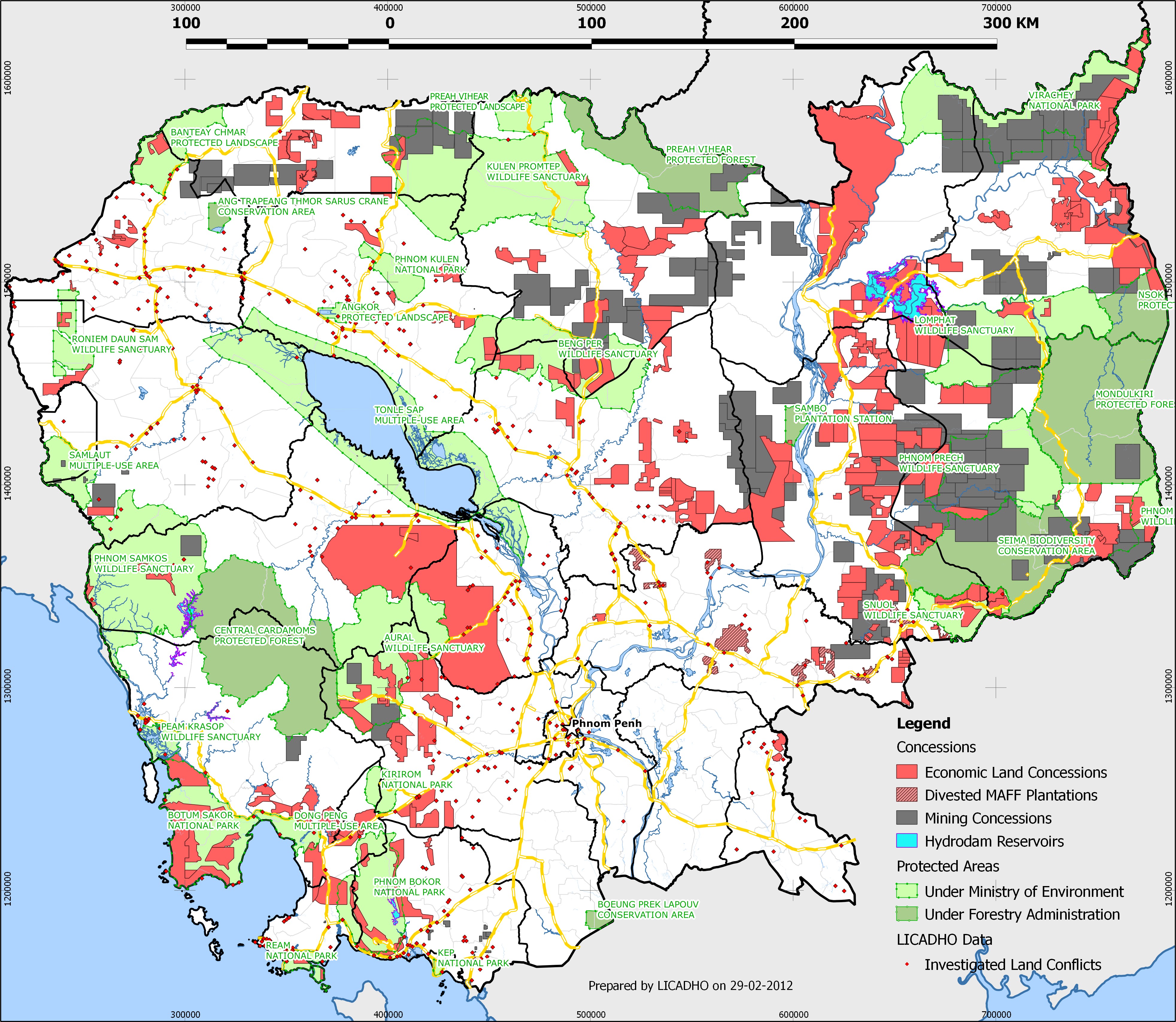
Cambodia is in the grips of a prolonged land grabbing crisis, a slow-motion calamity that has seen over 2.1 million hectares of land - roughly the total area of Wales - transferred mostly from subsistence farmers into the hands of industrial agriculture firms.
An estimated 400,000 people have been affected by land disputes since 2003, and government violence against land-grabbing victims is at an all-time high (the most shocking example coming when authorities shot dead a 14-year-old girl during an eviction). This large-scale transfer of land is facilitated by Cambodia's land concession scheme, in which the government leases - private state land - to companies that agree to farm it. Occupants rarely receive proper compensation, and many receive no compensation at all.
This interactive timeline map depicts land concessions granted by the Cambodian government since 1993. Over 2.1 million hectares have been leased to private entities.
(Note that this map only plots concessions which can be reliably located and dated. As such, the map is not representative of all land concessions granted in Cambodia)
To embed this interactive map any web page, simply make use of the HTML code below:
Get the data
- Concessions GeoJSON (EPSG: 900913)
Media coverage and map use
- Reuters' TrustLaw: Anti-Corruption Views: The great Cambodian giveaway (English op-ed)
- Voice of America (VOA): Interactive Map Shows Rapid Pace of Land Concession Grants (Khmer video)
- Voice of America (VOA): រដ្ឋាភិបាលផ្អាកផ្តល់ដីសម្បទានដល់ក្រុមហ៊ុនឯកជន (Khmer article)
- Phnom Penh Post: UN report Slams Cambodia's land abuses (English article)
- Global Witness: Interactive map shows scale and speed of Cambodia's land-grabbing crisis
Additional material
- The Cambodia Daily "Carving up Cambodia" article (in PDF format)
- High resolution map of land concessions in Cambodia (in JPEG format)